Quick Summary
- Another section of Orchard Road gets a new name
- Orchard Park Drive, Orchard Park Circle stay the same
- “Blue Ridge” comes from mountains visible to the west
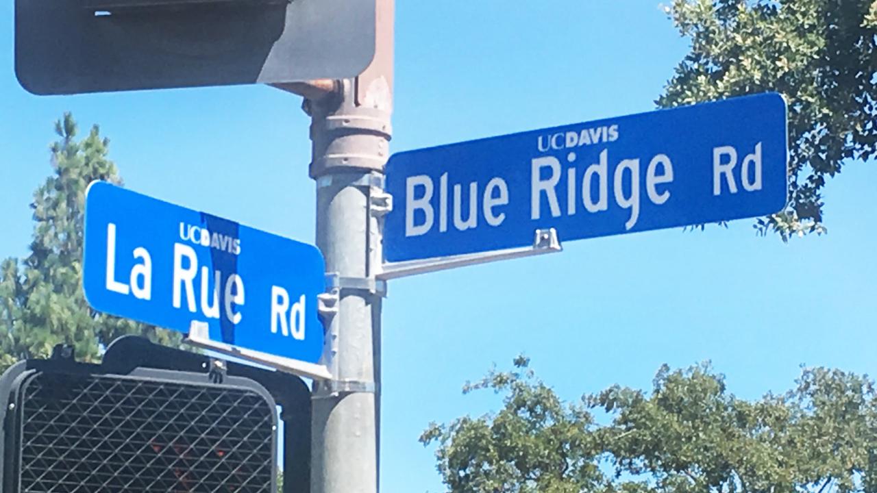
Confused about all the “Orchard”-named streets in the northwest corner of the central campus? You’re not alone, Transportation Services said recently in announcing a name change for Orchard Road between Orchard Park Drive on the west and La Rue Road on the east.
As of July 1, this section of road is called Blue Ridge Road — a change made, in part, to ease the name confusion. We’ll talk more about the name in a little bit.
The campus changed Orchard Road to Blue Ridge Road west of Orchard Park Drive a few years back. This section of Blue Ridge Road runs alongside the Baggins End domes housing area (on the south side of the road) and the Orchard Park apartments (north side), which are being rebuilt.
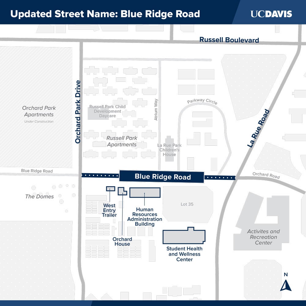
The name change does not apply to Orchard Park Drive (which runs north-south between Russell Boulevard and Extension Center Drive near the Rec Pool) or Orchard Park Circle (inside the Orchard Park apartment property). Nor does it apply to a short section of Orchard Road east of La Rue Road; this part of Orchard Road is essentially the driveway to the Activities and Recreation Center and the parking lot (25) in front of the ARC.
Blue Ridge Mountains
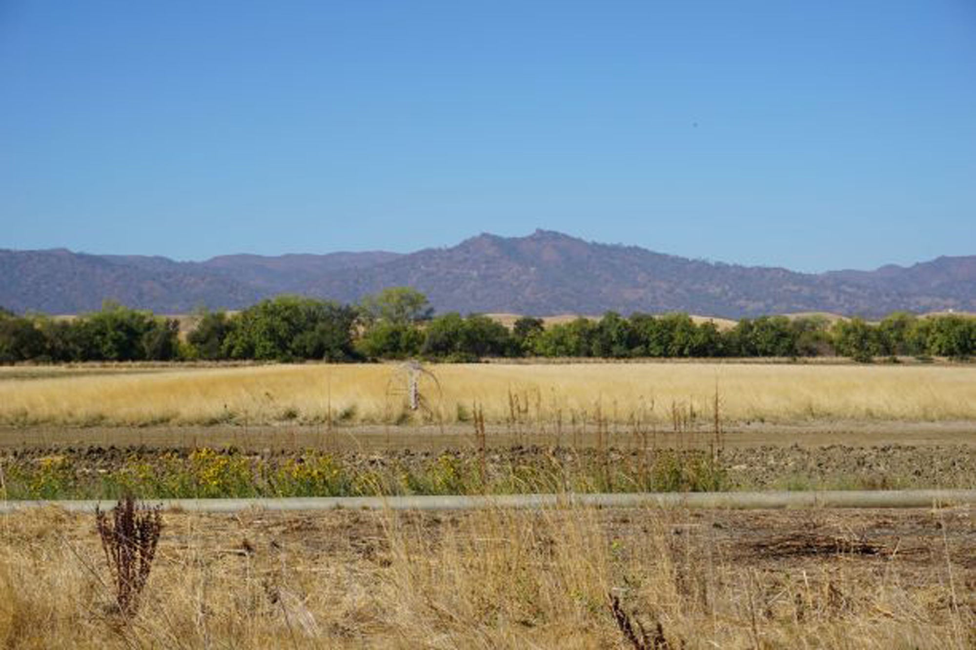
The next time you find yourself on Blue Ridge Road, look west to see (on a clear day) where the name comes from: the Blue Ridge Mountains that run from Fairfield in the south to Cache Creek and Lake Berryessa in the north, and which form the western border of Stebbins Cold Canyon Reserve, part of UC Davis’ Natural Reserve System. (Stebbins Cold Canyon Reserve includes the Blue Ridge Trail.) The ridge is part of the Northern Inner Coast Range.
“The new (street) name gives everyone from first responders to delivery drivers clearer direction when navigating the area,” Transportation Services said in its announcement. “Renaming Orchard Road as Blue Ridge Road also recognizes UC Davis’ important connection to the mountain skyline visible to the west of campus and visible from West Village.”
Do you have questions about the street name change? Share them with Transportation Services by email.
Ryan Jones of Transportation Services contributed to this report.
Media Resources
Dateline Staff: Dave Jones, editor, 530-752-6556, dateline@ucdavis.edu; Cody Kitaura, News and Media Relations specialist, 530-752-1932, kitaura@ucdavis.edu.