Out with the PDFs, in with the GIS: Campus road closures and detours can now be accessed on an interactive online map.
VISIT THE MAP
Previously, Design and Construction Management posted static PDF files showing how trips around UC Davis could be impacted by work. Now, a single interactive geographic information system, or GIS, map shows all of the boundaries, detours and dates that roads will be impacted by construction activity.
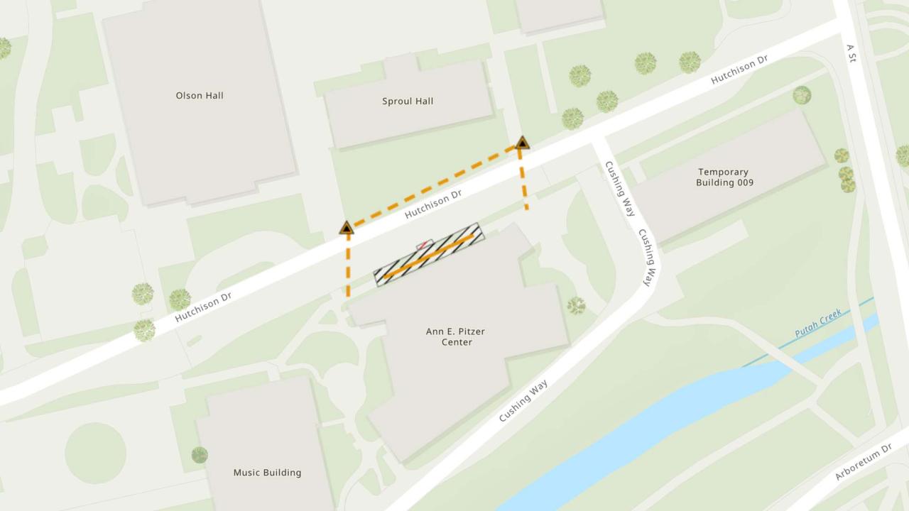
The new map is already in use, pointing out the fact that the sidewalk and parking area in front of the Ann E. Pitzer Center will be closed through Sept. 15 so workers can repair plaster on the canopy along Hutchison Drive. Another closure on the map: all traffic will be diverted around a section of Kleiber Hall Drive north of Kleiber Hall from Aug. 28-30.
“We hope this change will not only help campus students, staff, and faculty but also the general public with the ability to view to view the scope of construction related activities impacting roads and walkways,” said Steven Collins, an executive project analyst in Design and Construction Management.
Detours will be listed on the map approximately two weeks prior to the first day of the detour.
In the future, the map will show areas that are fenced off for construction; it currently shows one such project, the chemistry addition.
Media Resources
Cody Kitaura is the editor of Dateline UC Davis and can be reached by email or at 530-752-1932.