Typically, the primary indicator of a burgeoning wildfire in California is a plume of hazy, gray smoke wafting through the air, seen by satellites or cameras. The California Department of Forestry and Fire Protection, or CalFire, is alerted, and mitigation and containment efforts ensue.
But Zhaodan Kong, a professor in the Department of Mechanical and Aerospace Engineering at the University of California, Davis, thinks that living by the idea “where there’s smoke, there’s fire,” gets firefighters to the problem too late, after it has already spread and is difficult to contain.
“Right now, the way that it works is you see a fire and then you respond,” Kong said. “It’s very passive, very reactive.”
Instead, Kong, whose research in artificial intelligence and autonomy includes unmanned aerial vehicles, or UAVs, believes an integrated system of technologies to detect fires before they get to a smoking point could be game changing, potentially preventing widespread wildfire damage.
Sensors and sensibility
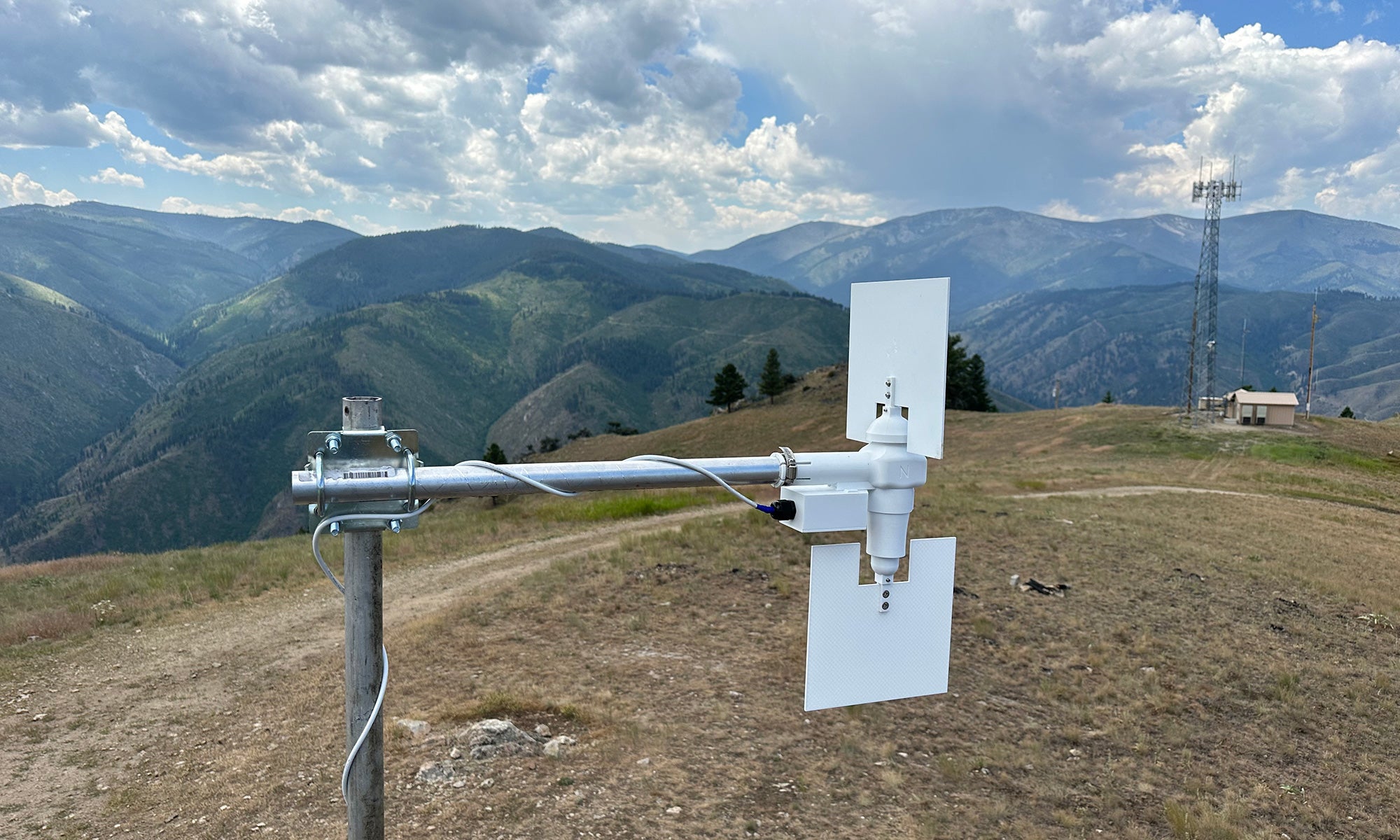
The detection would start on the ground with internet-connected sensors placed in strategic locations where wildfire events have occurred or are likely to occur (determined by CalFire). These palm-sized sensors, developed by Anthony Wexler, distinguished professor in the Department of Mechanical and Aerospace Engineering and director of the UC Davis Air Quality Research Center, measure temperature, humidity and wind speed to determine which areas could be at higher risk of a wildfire event.
“The things that cause a high wildfire-risk situation are high temperature, low humidity and high wind speed,” said Wexler, who has been working on these sensors for nearly a decade. “Temperature and humidity are relatively uniform over large geographical areas, but wind speed changes dramatically from place to place in California because of the topography.”
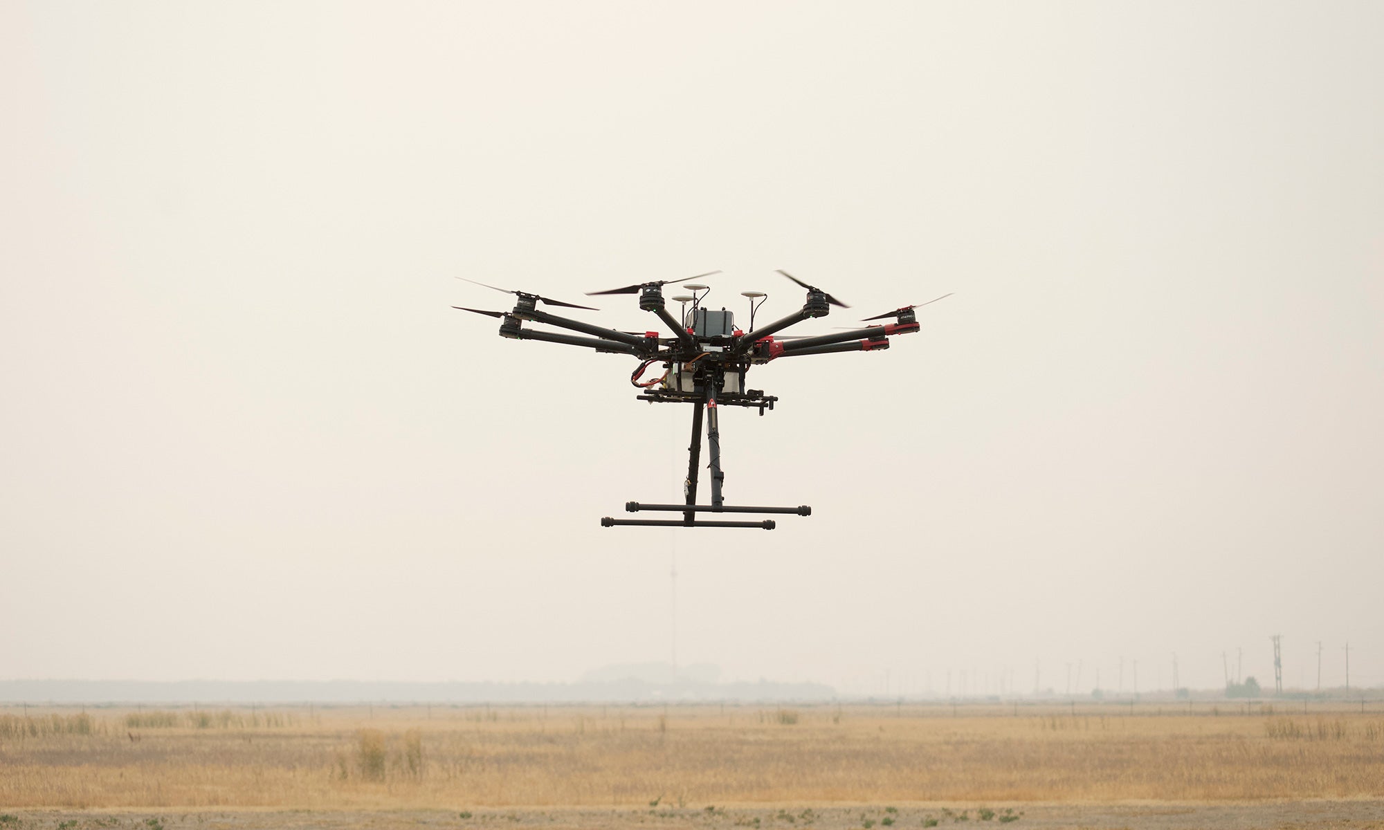
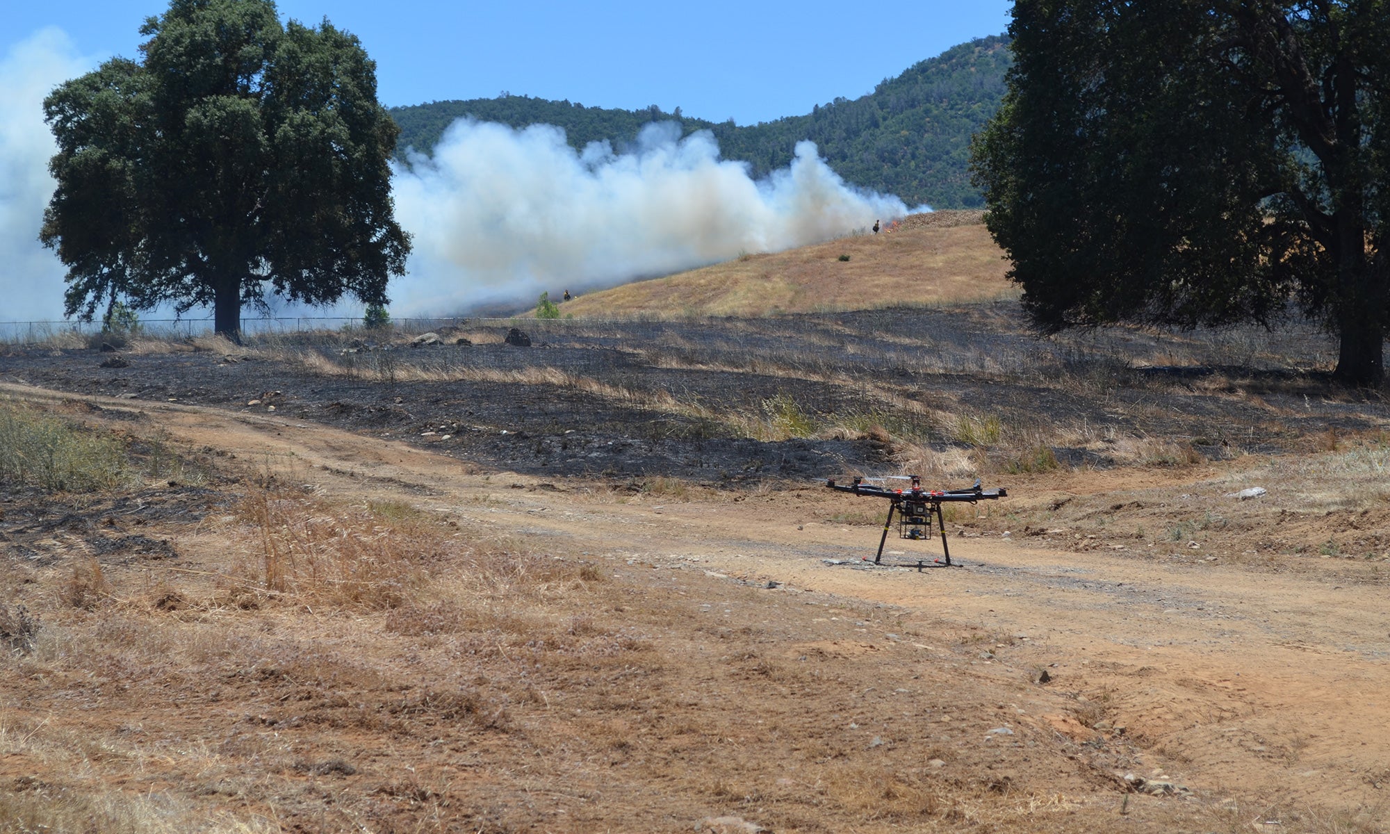
Once the triple threat — super dry soil, high temperature and strong wind — is detected, UAVs would then be sent out with payloads of cameras and chemical sensors to sweep the area for further indications of a fire, including elevated rates of particulate matter and carbon dioxide in the air, and then report any findings to CalFire.
“Chemical sensing is more sensitive than visual sensing,” Wexler said. “If you walk around your neighborhood and someone’s burning wood in their fireplace, you don’t see anything, but you smell it.”
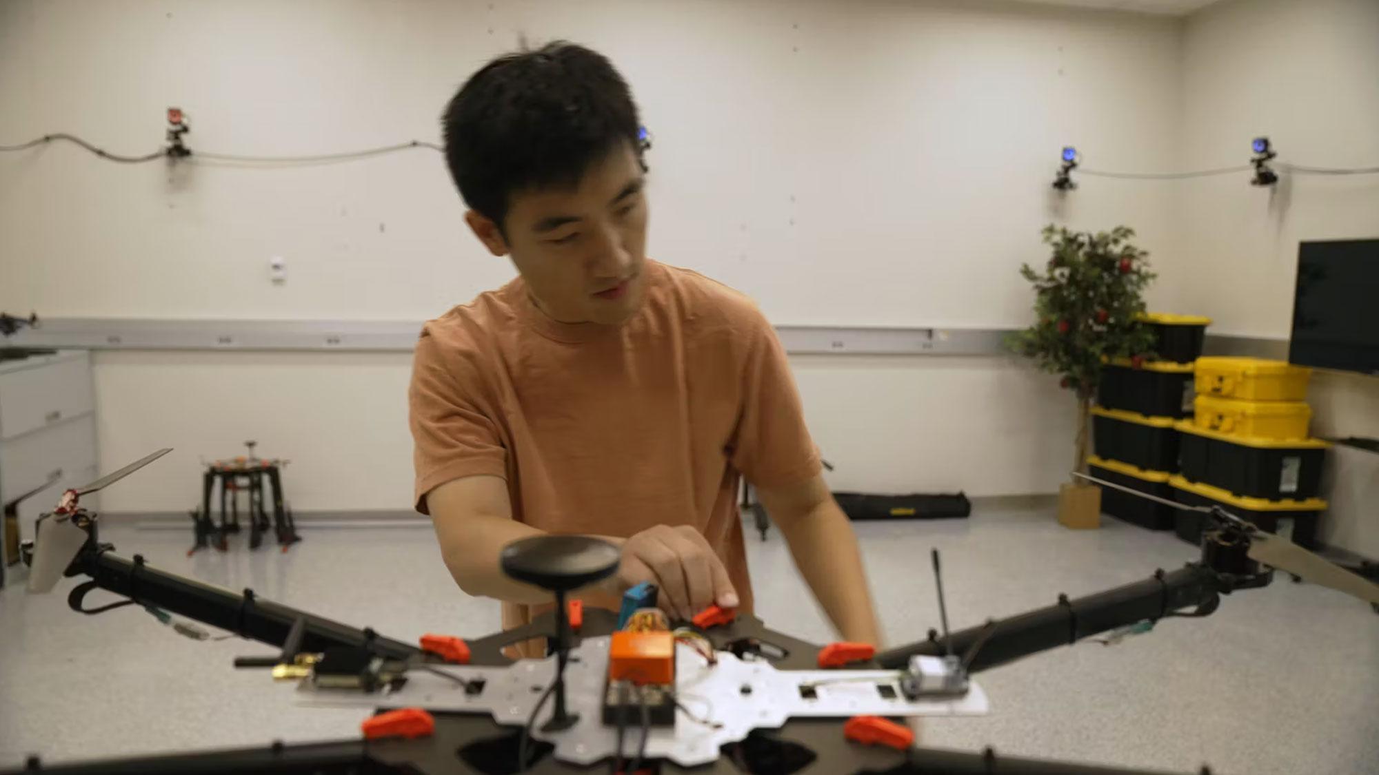
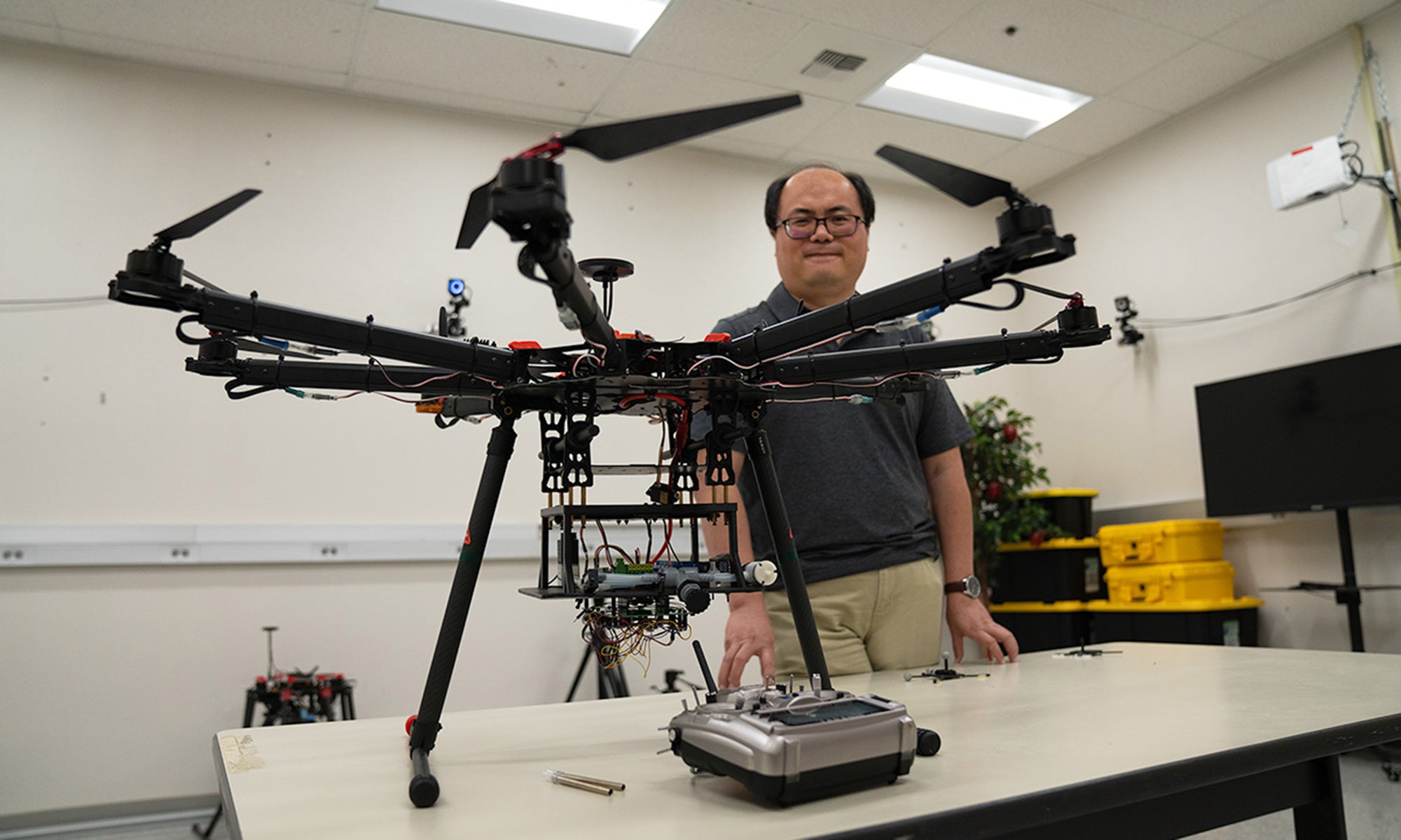
For these reconnaissance missions, Kong’s lab is building rotorcraft equipped with navigation systems, sensors and cameras. While one of the benefits of using rotorcraft is that they can land and take off from anywhere, one of the main challenges is a maximum flight duration of about 30 minutes. To combat this issue, Kong’s lab is developing a hybrid aircraft that can land and take off vertically like a rotorcraft, but also has qualities of a fixed-wing aircraft that can cruise at high altitudes for hours.
Catching fires
While many fire departments are using drones to drop water and fire retardants onto blazing fires, they may hesitate to accept the use of UAVs as a fire-detection tool. Cameras, satellites and manned aircraft are already crucial for tracking the spread of wildfires and determining the direction and speed with which they may be moving. Why add UAVs?
The current detection system, Kong and Wexler said, has gaps to fill. The 1,000 cameras set up on towers throughout the state and run by AlertCalifornia can only see a fire when it is within their field of view. Additionally, NASA’s fire-sensing algorithms scan for fires from satellites more than 500 miles above the Earth, making it difficult to determine a fire’s exact location and size.
By the time a fire is caught by these visual sensors and the information is relayed to the proper authorities, it has likely spread to a point where it might be difficult to contain. A manned aircraft still must fly over the fire and assess the situation before action is taken.
If UAVs are used to fly over wildfires, firefighters wouldn’t have to put their lives in danger in that capacity, Kong said. If the drone is overtaken by wildfire smoke and crashes into a tree or mountain, it’s just piece of technology, not a human life.
“Some of these wildfires are inside very challenging terrain, like if they’re inside a very deep valley and you have to fly the aircraft into that, it can be pretty dangerous,” said Kong. “We’re hoping to demonstrate that using UAVs can dramatically improve their safety.”
After the smoke has (mostly) cleared
Using UAVs to detect fires could also dramatically improve the health of firefighters and people in affected areas. Numerous medical studies link wildfire smoke, which comprises particulate matter, volatile organic compounds, carbon monoxide and other harmful chemicals, to adverse health effects including declines in lung function, inflammation and cardiovascular issues in firefighters. It has also been linked to decreased birthweight and preterm births, increased emergency room visits for pneumonia and acute bronchitis, and higher risk of death from COVID-19 and cardiovascular disease in communities where wildfire smoke has been prevalent.
Extreme wildfire events can also cause an extraordinary amount of damage. A 2020 paper analyzing the economic impact of California’s 2018 wildfires, reportedly “the deadliest and among the most destructive of any year in California history up to that time,” found $148.5 billion in damage, including 22,582 structures destroyed, caused by the 8,527 fires that burned 1.9 million acres that year.
Wildfires are also part of a climate-warming feedback loop. Environmental changes like increased drought, hotter temperatures and lower humidity are a breeding ground for a greater number of fires that last longer and are more intense. Those fires create greenhouse gas emissions and air pollution, contributing to climate change, and the cycle starts over.
Working better together
Kong, Wexler and other researchers know the damage done by wildfires cannot be undone, nor can wildfires be completely prevented. But knowing that we have to live with wildfires, creating this network of early detection could alert CalFire and other firefighting agencies to fires earlier so they can begin containment measures before the fires rage out of control, hopefully reducing the damage and deaths caused by them.
The two researchers, along with Jiawei Zhang, assistant professor in the UC Davis Department of Computer Science, and Avesta Sasan, associate professor in the Department of Electric and Computer Engineering, recently proposed their ideas for early wildfire detection to the National Science Foundation and California Climate Investments for funding.
“We are going to use the ground sensor network to predict the high risk, and then the UAVs to patrol the area to find the fire, and then we are going to alert the authorities and fly out,” said Kong. “It has to be satellites, watchtowers, UAVs, manned aircraft, ground sensors, all the mechanisms working together in order to have a system to predict and detect wildfires.”
Media Resources
Media Contact:
- Andy Fell, News and Media Relations, 530-752-4533, ahfell@ucdavis.edu
Press kit of images and b-roll for download