Quick Summary
- At current emission rates, half of Sierra, Central Valley and Southwest California lands to be impacted
- Even if emissions are cut now, about a quarter of state’s vegetation will still be climate stressed by 2100
- If we continue with business-as-usual emissions, amount of impacted land doubles to more than 50 percent
Current levels of greenhouse gas emissions are putting nearly half of California’s natural vegetation at risk from climate stress, with transformative implications for the state’s landscape and the people and animals that depend on it, according to a study led by the University of California, Davis. However, cutting emissions so that global temperatures increase by no more than 2 degrees Celsius (3.2 degrees Fahrenheit) could reduce those impacts by half, with about a quarter of the state’s natural vegetation affected.
The study, published in the journal Ecosphere, asks: What are the implications for the state’s vegetation under a business-as-usual emissions strategy, where temperatures increase up to 4.5 degrees Celsius by 2100, compared to meeting targets outlined in the Paris climate agreement that limit warming to 2 degrees Celsius?
“At current rates of emissions, about 45-56 percent of all the natural vegetation in the state is at risk, or from 61,190 to 75,866 square miles,” said lead author James Thorne, a research scientist with the Department of Environmental Science and Policy at UC Davis. “If we reduce the rate to Paris accord targets, those numbers are lowered to between 21 and 28 percent of the lands at climatic risk.”
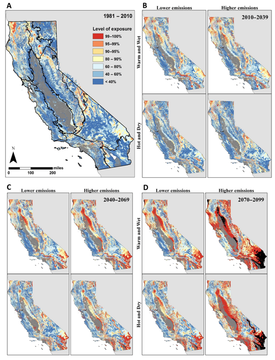
The report notes that this is a conservative estimate because it only examines direct climate exposure. It does not include increased wildfire or insect attacks on forests, which are also intensifying and likely to increase with further warming. These secondary effects are likely to have large impacts, as well, the authors say. For example, during the recent drought, more than 127 million trees died primarily due to beetle outbreaks, and wildfires have consumed extensive amounts of natural vegetation.
68 percent of LA, San Diego regions impacted
The study features maps of the state and shows the climate risk to 30 different vegetation types under different climate scenarios. It projects that at current rates of greenhouse gas emissions, vegetation in southwestern California, the Central Valley and Sierra Nevada mountains becomes more than 50 percent impacted by 2100, including 68 percent of the lands surrounding Los Angeles and San Diego.
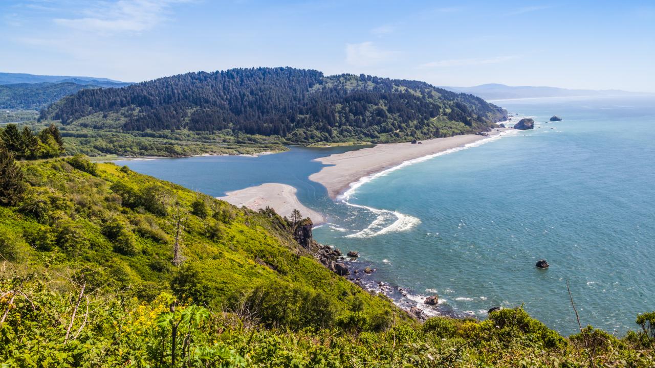
“This is the map of where we live,” Thorne said. “The natural landscapes that make up California provide the water, clean air and other natural benefits for all the people who live here. They provide the sanctuary for California’s high biodiversity that is globally ranked. This map portrays the level of climate risk to all of those things. In some cases, the transformation may be quite dramatic and visible, as is the case with wildfire and beetle outbreaks. In other cases, it might not be dramatically visible but will have impacts, nevertheless.”
Resilient areas also identified
The study and its maps are being used by state agencies and land managers to make decisions under changing conditions. Commissioned by the California Department of Fish and Wildlife, the data is helping the agency understand not only which parts of the state are vulnerable to climate change, but also which areas are more resilient, such as some coastal areas and parts of northwestern California, so they can ensure they remain resilient.
“In California, we have good information on the vulnerability of fish and wildlife to climate change,” said Whitney Albright, a project manager with the California Department of Fish and Wildlife. “But we were missing this crucial piece of climate risks to underlying habitat. This study helped fill the information gap. We’ve already started to use its data in our conservation planning efforts.”
The study also provides a risk assessment for policymakers to consider the benefits to California of reaching Paris climate agreement emission targets that limit global warming to 2 degrees Celsius, and the risks to the state of remaining on the current business-as-usual level of emissions and temperature warming.
Co-authoring institutions included the California Department of Fish and Wildlife, Sequoia and Kings Canyon National Parks, and the U.S. Geological Survey.
The study was funded by the U.S. National Park Service and the California Department of Fish and Wildlife.
Media Resources
James Thorne, UC Davis Environmental Science and Policy, 530-752-4389, jhthorne@ucdavis.edu
Kat Kerlin, UC Davis News and Media Relations, 530-750-9195, kekerlin@ucdavis.edu