Quick Summary
- UC Davis and the city of Davis are seeking community input
- Potential joint project would convert land once mined for soil
- Walking loop and ADA accessibility are included in the plan
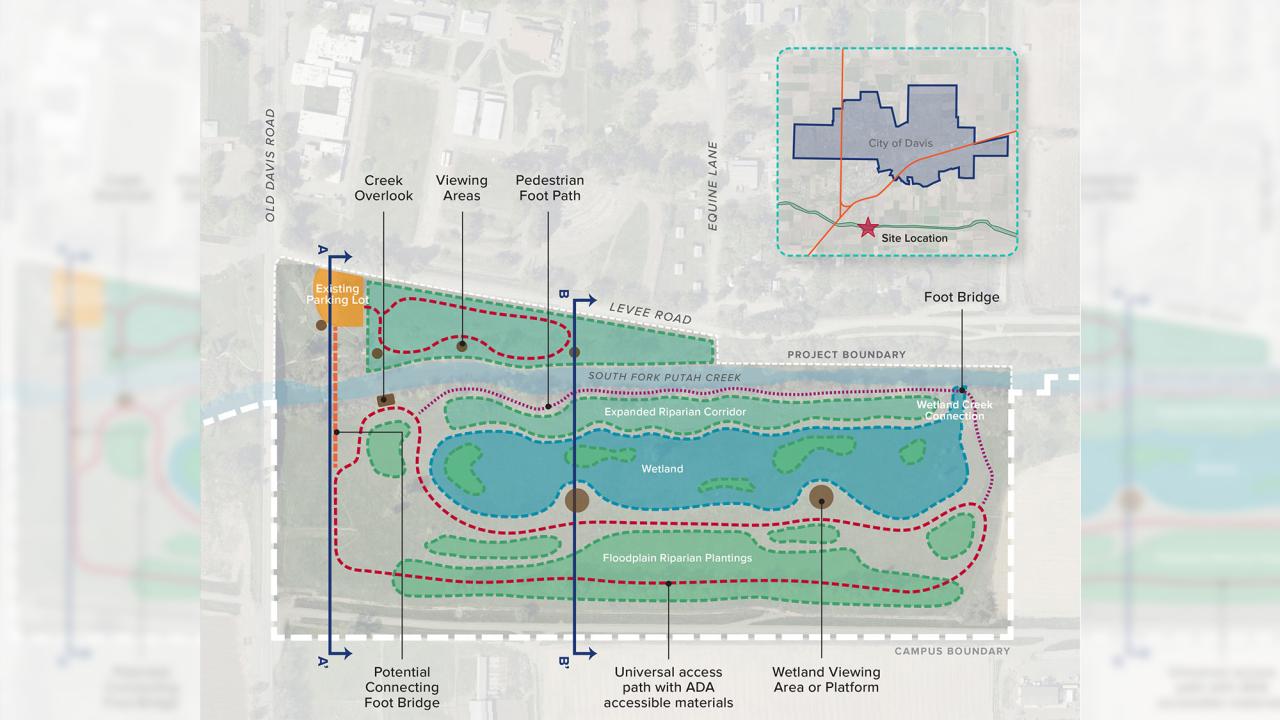
UC Davis and the city of Davis are looking for early community input on a possible joint habitat enhancement and public access project called Putah Creek Wetlands on university-owned land between Levee Road and the Davis campus’s southern boundary.
The 32-acre project site lies along the south fork of Putah Creek near the Old Davis Road bridge.
Members of the public have three opportunities to visit the site with university and city officials. No reservations are necessary.
- Wednesday, May 11 — noon
- Saturday, May 14 — 10 a.m.
- Wednesday, May 18 — 5 p.m.
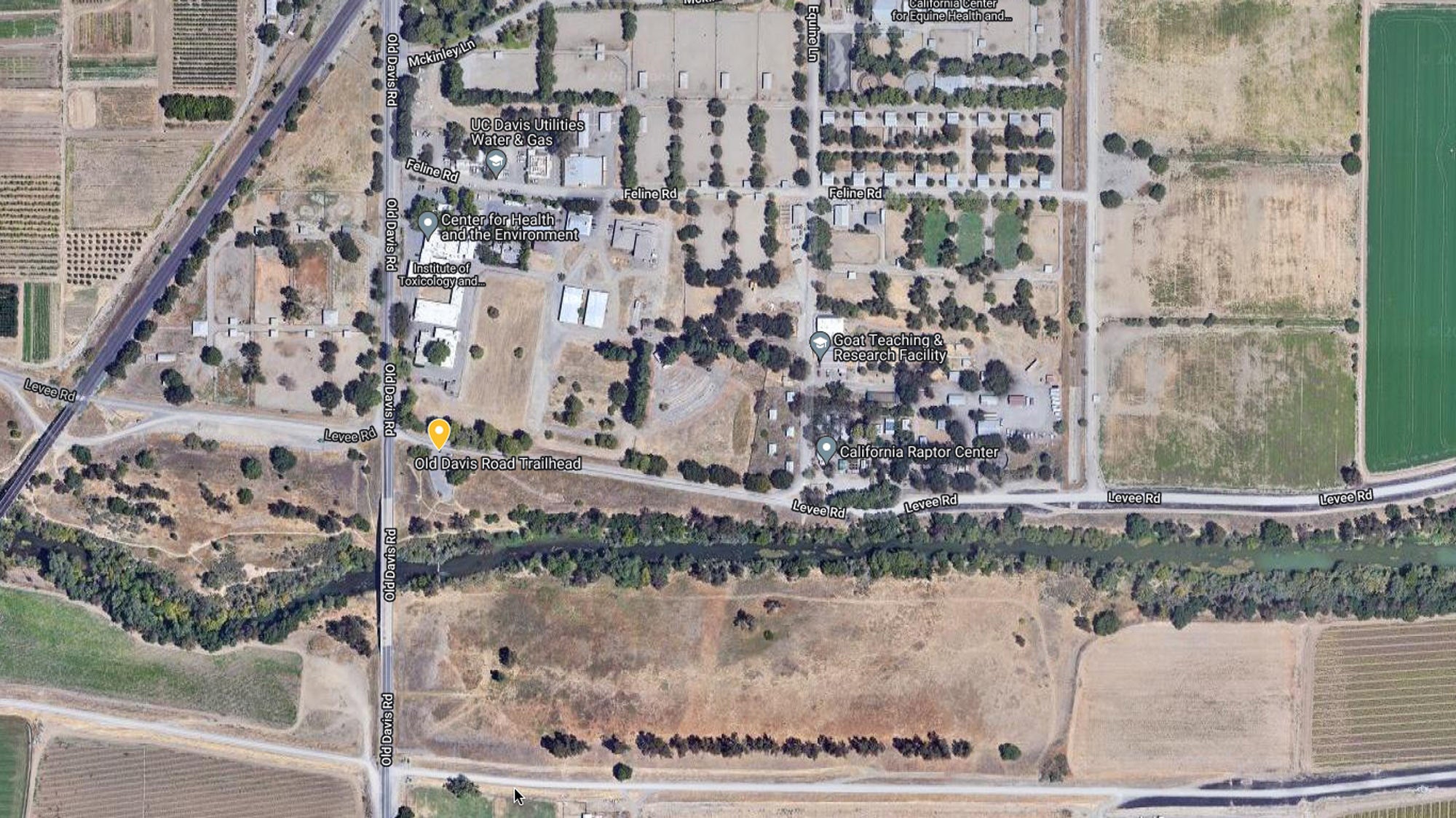
Participants are asked to meet in the parking lot on Levee Road east of Old Davis Road, then walk as a group to the site. Please note that the site is not accessible — under the Americans With Disabilities Act, or ADA — at this time. But, making it accessible to all is one of the project’s goals, and the city has engaged its ADA Committee in the project.
The potential restoration site was historically a soil mining area used to export soil for nearby freeway interchanges. The elevation of the post-mining surface is too high for wetland and riparian vegetation but too low for an oak woodland. As a result of this historic mining activity, the site now hosts invasive weeds and eucalyptus trees.
The proposed restoration concept would create an off-channel wetland area, expand the riparian forest, and replant with native trees, shrubs and grasses. The wetland would be a permanent, year-round feature that would rise and fall with the creek. A connection between the creek and wetland would allow for fish to move between the two areas.
A walking loop around the site would be accessible via a pedestrian bridge across the creek from the existing gravel parking area.
For more information about the on-site community meetings, send an email to Tracie Reynolds, city’s open space program manager.
Media Resources
Dateline Staff: Dave Jones, editor, 530-752-6556, dateline@ucdavis.edu; Cody Kitaura, News and Media Relations specialist, 530-752-1932, kitaura@ucdavis.edu.