
Quick Summary
- Popular hiking area, a UC Davis reserve, will see weekend highs near 101
- New app pinpoints your progress, can help you decide to turn around
- High fire danger persists, as demonstrated by Canyon Fire near the reserve
Earlier this week, it was a nearby wildfire that kept people off the trails at UC Davis’ Stebbins Cold Canyon Reserve. This weekend it is high heat that should have people thinking twice before going.
The National Weather Service has issued a heat advisory, 11 a.m. Saturday to 11 a.m. Sunday (July 27-28), for much of the Sacramento Valley and extending into the Coast Ranges, including Stebbins Cold Canyon at the south end of Lake Berryessa. The weather service is predicting high temperatures near 101 degrees at the reserve.
“The heat is just as dangerous as wildfire,” said Jeffrey Clary, associate director of UC Davis Natural Reserves. UC Davis discourages hiking at Stebbins in very hot weather and during periods of high risk of fire or flood.
HEAT ADVISORY
From the July 27-28 heat advisory, predicting high temperatures of 100 to 109 degrees in the Central Valley and foothills:
- Increased chance of heat stress or illnesses to people and animals
- Drink extra water
- Avoid outdoor strenuous activities 10 a.m.-6 p.m.
- Help elderly, kids and pets stay cool
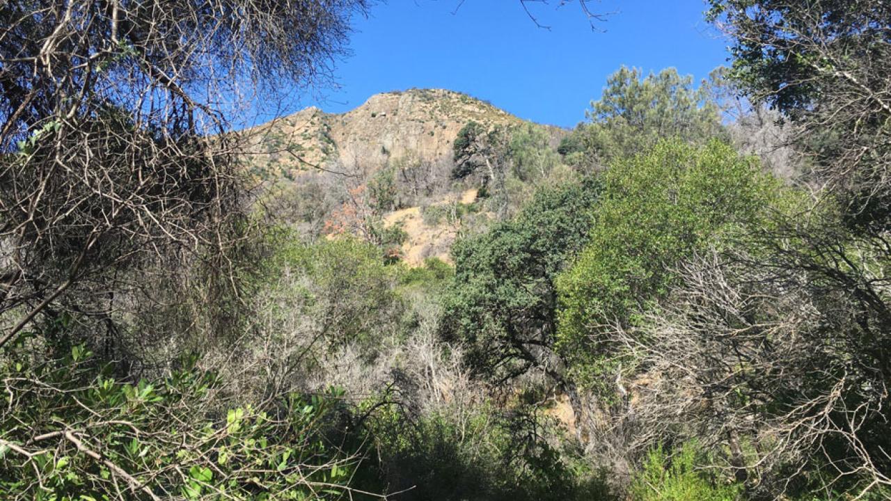
Stebbins is seeing two out of three this week: heat and fire danger. The Canyon Fire broke out early Monday afternoon (July 22) southwest of the reserve and covered 64 acres before the California Department of Forestry and Fire Protection reported 100 percent containment Thursday (July 25). And while relatively high humidity helped keep the fire in check, a predicted north slope wind this weekend would bring the humidity down.
“So, we’re looking at prime fire conditions, along with terrible conditions for hiking,” Clary said.
Stebbins Cold Canyon managers have posted this message in a red box on the reserve’s website: “The National Weather Service is forecasting very high temperatures, low humidity and north winds through the weekend. These are very dangerous conditions for hiking in wildlands. High risk of fire and heat illness.”
Signs are up at the reserve, too, including new graphics showing 1-gallon water bottles, indicating the recommended amount of water you should take on your hike (and remember, there is no water on site, so fill those bottles before you come). Two thermometers have also been set up.
First-responders concerned
The Solano County Office of Emergency Services and the Vacaville Fire Protection District are also concerned. They are first responders to 911 calls at Stebbins — calls that invariably come in during times of high heat. Most of these calls are for heat stroke, which can have lifelong consequences and is potentially fatal.
As they have done in the past, the agencies were rounding up volunteers to station themselves in the Stebbins Cold Canyon parking lot, to caution would-be hikers about the heat danger this weekend.
For those who go anyway, say, taking the Blue Ridge Loop (5 miles, 1,600 feet of climbing), the first-responders offer this advice: Start early enough so as to complete your hike before the temperature reaches 80 to 85 degrees. Often this means starting no later than 9 a.m., earlier on some days.
And, for hikers not used to strenuous exercise in significant heat, first-responders encourage shorter training hikes: “It requires exercising one to two hours a day in 80- to 95-degree heat for 10 to 14 days to become fully acclimated to exercising in heat.”
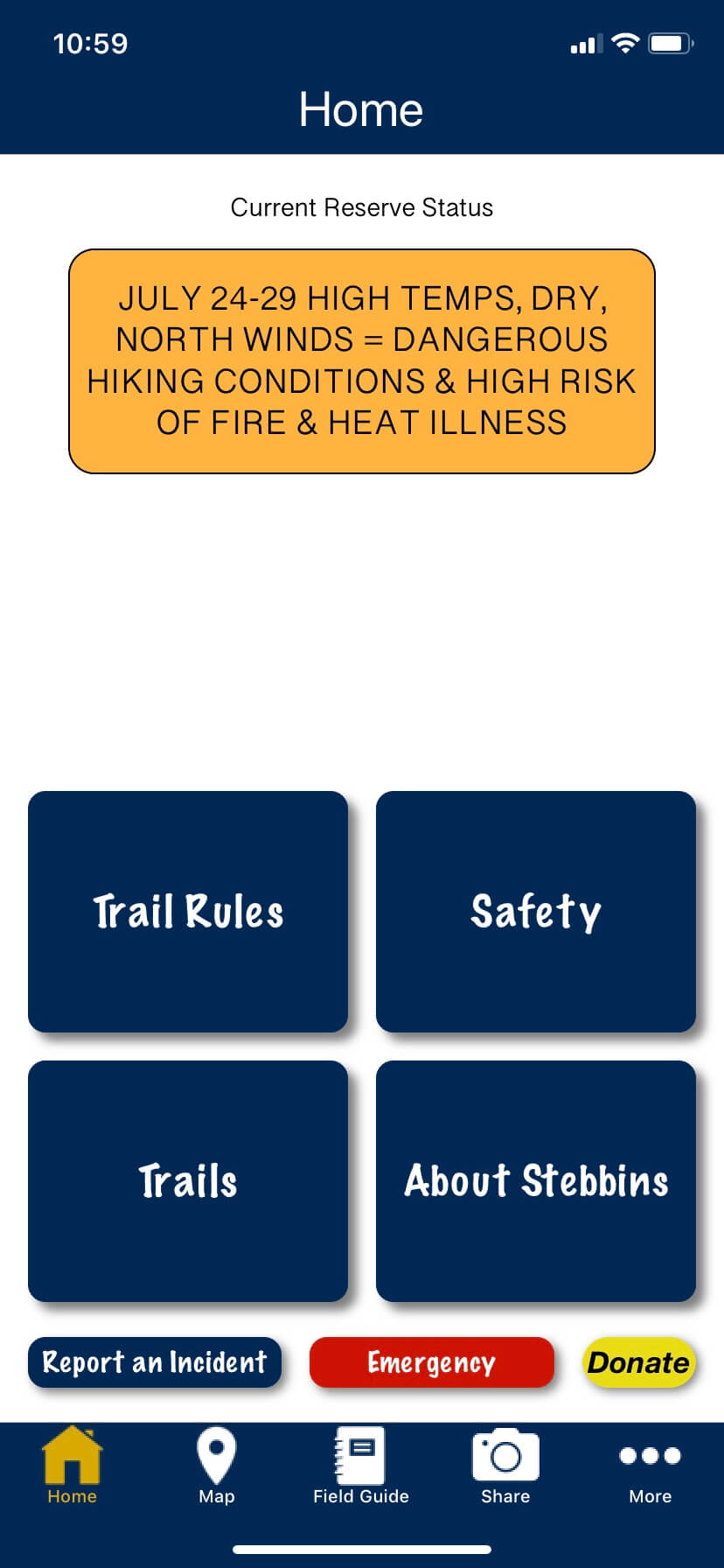
New app for hikers
Stebbins Cold Canyon Reserve managers advise hikers: Check the weather, carry lots of water (at least 1 gallon per hiker) and turn around if you think the heat is getting to you. But how do you decide when to turn around on a loop trail? If you think you’ve gone halfway or more, you might decide to press on. Many times, though, people have not gone as far as they think they have, and turning around would have been a better decision.
So, how do you know how far you’ve gone? With GPS tracking on your smartphone, on a new app developed by UC Davis computer engineering students and unveiled three weeks ago. GPS, of course, works off satellites — so there’s no need for internet service, which is unavailable at Stebbins. But you will need the internet to get the app — so be sure to download it before you go. It’s available at this time for iOS only (search for “Stebbins Cold Canyon” in the Apple App Store, and you’ll need iOS version 11.3 or later).
Media Resources
Jeffrey Clary, UC Davis Natural Reserve System, 530-752-9178, jjclary@ucdavis.edu
Sarah Oktay, UC Davis Natural Reserve System, 530-752-6949, sdoktay@ucdavis.edu